How BIM Drones and 3D Printing Are Transforming Construction and Surveying

Construction has always been a physical industry, but some of its biggest gains now happen before anyone pours concrete, lifts steel, or sets out a site boundary. A model can reveal a clash before it becomes a rework claim. A drone can map a site in minutes rather than hours. A 3D printer can turn a digital file into a building component with less waste and fewer manual tasks.
These tools are not replacing judgement, craft, or field experience. They are changing where that expertise is used. Surveyors, engineers, site managers, architects, and contractors can now work with better information earlier, then carry that information through design, procurement, construction, and maintenance.
The impact is clear in three areas that matter on every project:
Efficiency, because teams spend less time repeating work or waiting for data.
Accuracy, because digital models and sensors reduce guesswork.
Safety, because fewer people need to enter hazardous areas for checks, inspections, and measurements.
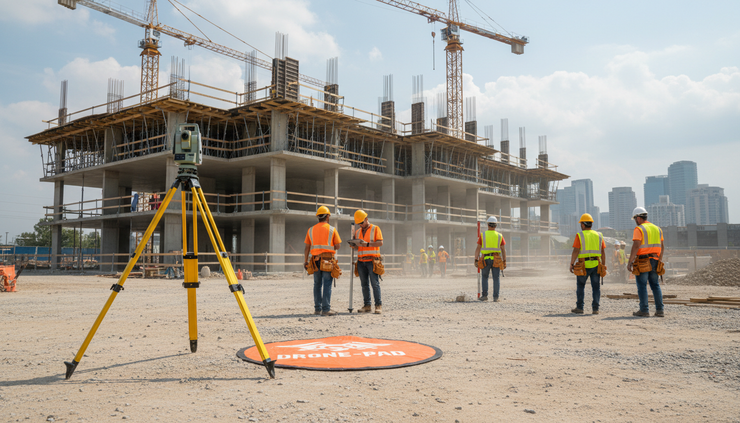
BIM is changing how project teams plan and build
Building Information Modelling, usually called BIM, gives teams a shared digital model of a built asset. That model can include geometry, materials, programme data, costs, maintenance information, and asset records.
The real value is not the 3D view on screen. It is the way BIM helps different disciplines work from a common source of truth. Architects, structural engineers, MEP designers, contractors, quantity surveyors, and facilities teams can all see how decisions affect each other.
On complex projects, this matters. A ventilation duct that clashes with a steel beam may look like a small coordination issue during design. On site, it can mean delay, redesign, wasted materials, and unsafe improvisation. BIM helps catch those issues while they are still cheap and easy to fix.
BIM improves coordination before work starts
Traditional drawings still have a place, but they can hide spatial conflicts. BIM makes many of those conflicts visible.
Clash detection can flag issues such as:
Pipes running through structural members
Cable trays blocking maintenance access
Plant rooms with insufficient clearance
Stair and lift cores misaligned across disciplines
Temporary works conflicting with permanent works
For contractors, that can mean fewer surprises. For surveyors, it can mean tighter links between design intent and site reality. For clients, it can mean better confidence that all parties are working to the same information.
The UK public sector helped push BIM into wider use when centrally funded public projects began requiring collaborative 3D BIM from 2016. That requirement shifted BIM from a specialist design tool into a normal part of delivery for many large projects.
Crossrail showed the value of digital asset information
Crossrail, now operating as the Elizabeth line, is often cited as a major example of digital information management in UK infrastructure. The project involved stations, tunnels, rail systems, utilities, and a huge range of contractors.
BIM and related digital asset data helped teams manage complex interfaces and prepare information for long-term operation. The benefit was not limited to design coordination. The digital records created during delivery also supported the handover of asset information to those responsible for operating and maintaining the railway.
That is one of BIM’s most important lessons. A good model should not die at practical completion. If the data is structured well, it can support inspection, refurbishment, facilities management, and future upgrades.
BIM helps surveying connect the model to the real site
Surveyors play a key role in keeping BIM grounded in reality. Laser scans, total stations, GNSS receivers, and mobile mapping can feed accurate field data back into the model.
This creates a stronger feedback loop:
Traditional workflow | BIM-enabled workflow |
Designers issue drawings, then surveyors set out from them | Teams link design models with survey control and field data |
As-built records are often gathered late | As-built conditions can be captured throughout the project |
Errors may appear during installation | Differences can be checked earlier against the model |
Handover information may be fragmented | Asset data can be organised for future use |
This link between BIM and surveying is especially useful on refurbishment projects. Existing buildings rarely match old drawings perfectly. A laser scan can capture hidden irregularities, then designers can model around real conditions rather than assumptions.

Drones are making surveying faster and safer
Drones, or unmanned aerial vehicles, have become one of the most visible technology changes on construction sites. They can capture aerial images, video, thermal data, and photogrammetry that turns overlapping photographs into measurable 3D models.
For surveying, drones are especially useful because they collect data quickly over large or difficult areas. A team can map earthworks, stockpiles, roofs, facades, bridges, quarries, and infrastructure corridors without sending people into every part of the site.
That does not remove the need for trained surveyors. Drone data still needs planning, control points, processing, checking, and interpretation. A poor flight plan or weak ground control can produce poor results. When used well, drones add speed and reach to professional surveying.
Progress tracking becomes more visible
Aerial imagery makes site progress easier to understand. Instead of relying only on written updates and ground photographs, project teams can compare regular drone captures against the programme, BIM model, or previous flights.
This helps with:
Measuring earthworks progress
Checking installed elements against planned sequences
Recording site conditions before and after key works
Supporting payment applications with visual evidence
Identifying access issues, storage problems, or congestion
On large schemes, drone maps can give managers a shared view of the whole site. That can reduce the time spent walking long distances simply to understand what has changed.
Drones reduce exposure to hazardous areas
Safety is one of the strongest arguments for drone use. Inspections often involve height, confined space, water, unstable ground, live traffic, rail lines, or fragile structures. A drone can gather initial visual data while keeping people at a safer distance.
Network Rail has used drones to inspect parts of the rail network, including structures and trackside assets. The benefit is clear. If a drone can carry out a visual check without workers standing near live railway environments, it reduces exposure to risk and can limit disruption.
Drones are also used for bridge inspections, roof surveys, and facade checks. They do not replace hands-on inspection where close testing is needed, but they can help teams decide where to focus attention. That makes site visits more targeted.
Case study examples show where drones fit best
Drones are especially useful where the project has one or more of these conditions:
A large footprint, such as housing sites, highways, energy projects, or rail corridors
Regular progress reporting needs
Difficult access, such as steep slopes, water edges, or unstable structures
High-risk inspection zones
Repeated measurement tasks, such as stockpile volumes
A quarry or earthworks project is a simple example. Traditional stockpile measurement can be slow and may expose staff to moving plant or uneven ground. A drone survey can capture the area from above, process a surface model, and support volume calculations. The result still needs professional checking, but the fieldwork becomes faster and safer.
For building projects, regular drone captures can create a visual record of construction. That record can help resolve disputes, document sequencing, and give clients a clearer view of progress without frequent site access.

3D printing is reshaping how components are made
3D printing in construction, also called additive manufacturing, creates objects layer by layer from a digital design. In building work, this may involve concrete, polymers, metals, or specialist materials. It can be used for full structures, facade elements, moulds, formwork, fittings, prototypes, or replacement parts.
The most dramatic images often show 3D-printed houses, but the quieter use cases may have the biggest effect in the near term. Printing complex formwork, bespoke components, and prototypes can speed up design testing and reduce waste.
3D printing can reduce material waste
Traditional construction often removes material to create a final form. Cutting, trimming, and over-ordering can create waste. Additive manufacturing builds only where material is needed, although the full environmental impact depends on the material, energy source, transport, and design.
The design freedom is also useful. Curved forms, voids, textured surfaces, and complex shapes can be printed without the same labour demands as conventional methods. That can support more efficient structural forms, not just unusual architecture.
For surveyors and engineers, the key point is that printed work starts with digital geometry. Accurate modelling, tolerances, and quality checks matter. The printer can only build from the information it receives.
Amsterdam’s 3D-printed steel bridge proved the concept in public
The MX3D bridge in Amsterdam is one of the best-known examples of metal 3D printing in the built environment. The project used robotic arms to print a stainless steel pedestrian bridge, which was later installed across a canal.
Its importance was not simply that it looked striking. It showed how digital design, robotic fabrication, sensing, and structural engineering can come together in a real public asset. The bridge also became a test case for monitoring how a printed metal structure behaves over time.
That kind of monitoring matters. 3D printing changes how components are made, so the industry needs strong evidence on performance, durability, inspection, and repair. Demonstration projects help build that knowledge.
Printed buildings are moving from demonstration to delivery
Several projects around the world have used 3D-printed concrete for homes, offices, and community buildings. Dubai’s 3D-printed office building, opened in 2016, became an early high-profile example. In Germany, printed homes and apartment buildings have shown that additive methods can meet real building needs when combined with conventional services, reinforcement strategies, and regulatory approval.
The lesson is practical. 3D printing does not remove foundations, building services, waterproofing, fire safety, access requirements, or quality assurance. It changes parts of the construction process. The strongest uses are likely to be those where printing solves a clear problem, such as labour-intensive shapes, fast prototyping, remote production, or reduced formwork.

The biggest gains come when technologies work together
BIM, drones, and 3D printing are powerful on their own. Their real potential grows when they connect.
A drone can capture site conditions and create a point cloud or surface model. That data can be compared with a BIM model to check progress or identify differences. A 3D-printed component can be produced directly from a coordinated digital design. Survey data can confirm whether the printed or installed element matches the required position.
This creates a digital thread from idea to asset:
Design information starts in a coordinated model.
Survey data checks the real site against that model.
Drone mapping records progress and conditions.
Fabrication data guides printed or prefabricated components.
As-built information supports operation and maintenance.
The result is not perfection. Projects still face weather, supply constraints, ground conditions, regulation, and human error. Technology does not remove the need for clear responsibility or skilled management. Poor data can create false confidence.
The best results come when teams set rules early:
Who owns each data set
What accuracy is required
How models will be checked
Which file formats will be used
How field changes will be recorded
What information the client needs at handover
Without those basics, digital tools can create more noise. With them, they can reduce waste, delay, and risk.
What this means for the future of construction and surveying
The direction is clear. Construction and surveying are becoming more data-rich, more visual, and more connected. BIM helps teams plan and coordinate. Drones help them measure and inspect. 3D printing helps them turn digital designs into physical components in new ways.
The benefits are practical rather than abstract. Fewer clashes. Faster surveys. Better records. Safer inspections. Less rework. Clearer handover information. These gains matter because construction margins are tight and project risks are real.
The most successful firms will not adopt technology for appearance. They will use it where it solves a defined problem, train people properly, and connect digital workflows to site reality.
The future of construction is not only about machines, models, or automation. It is about giving skilled people better tools, better information, and safer ways to build.
Comments